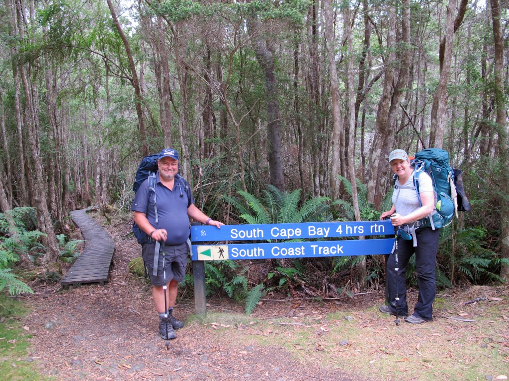
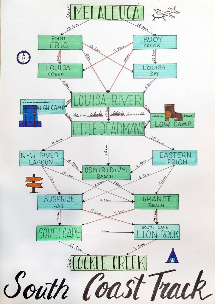
In January of 2019, we hiked the amazing and remote South Coast Track in the south-west wilderness area of Tasmania. Read on for a full account of our nine day adventure.
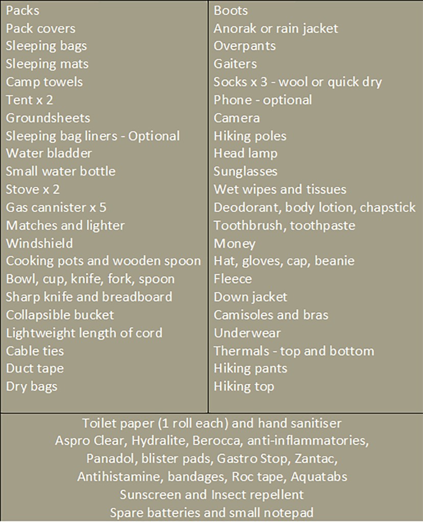
Links at the end are provided to gear and provisions lists. We weighed our packs at check-in for the flight to the start of the walk – Erin 27 (17kg), Nicole 49 (20kg), Lisa 54 (18kg) & Gordon 57 (19kg).
Day 1 – Melaleuca to Point Eric
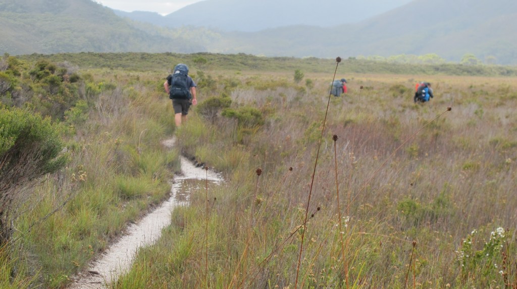
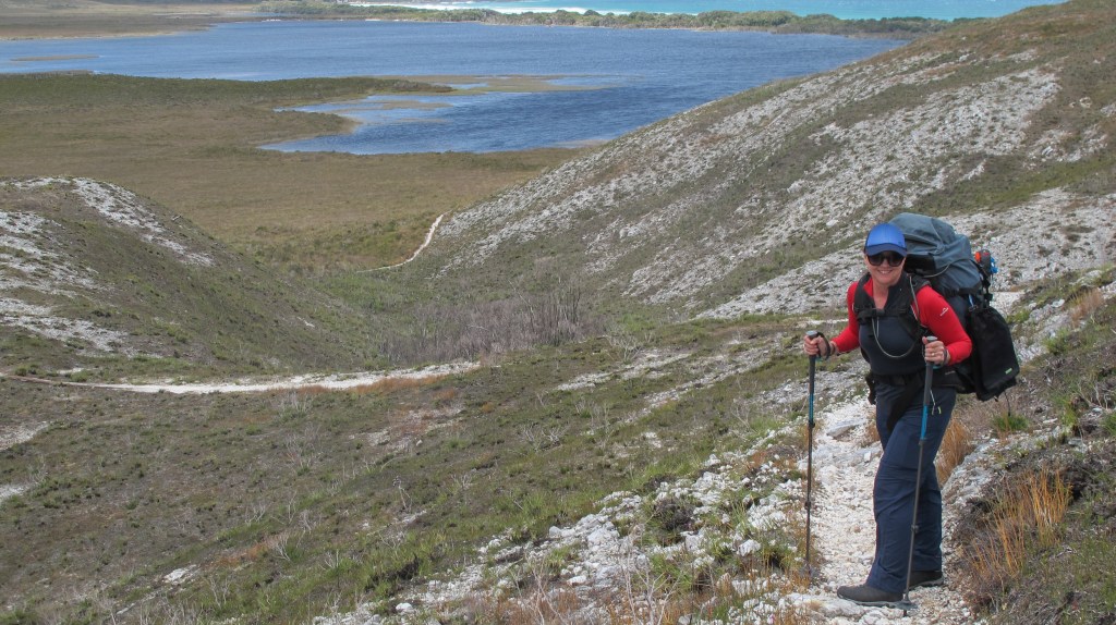
The silvery thread of the duckboards tug my feet toward the ocean. Buttongrass plains stretch in each direction, meeting a ring of distant mountains. It is a vast and wild landscape. The pass our plane had attempted to fly through, just an hour earlier, is in view.
It was a tense ride, that flight. First, climbing up and over the thick smoke blanketing Hobart from all the bushfires – we weren’t sure until the last moment we would even be able to start this long-awaited trip. The pilot set course directly to Bathurst Harbour, flying into a headwind. Once over Preciptious Bluff, an impressive, craggy outcrop we can only glimpse, he turns south towards clearer sky, in preparation for descent. He warns us that things may get bumpy. I can feel the small plane struggling against the currents but the turbulence remains mild. The pilot doesn’t speak to us much but we can hear his conversation with another plane about 20 minutes behind us. He is guiding that pilot. All seven passengers are silent. Nicole and I squeeze hands. The plane is pointed between the hills either side of Cox’s Bight and then suddenly, it’s not. We climb and bank right, the pilot explaining he is getting some height and attempting another route. This time we glide easily over the beach at New Harbour, the hills are further apart here and the currents easier. Finally (and thankfully because I am busting for the loo) we circle the small landing field at Melaleuca. The pilot executes a gentle landing and we all clap. Relieved.
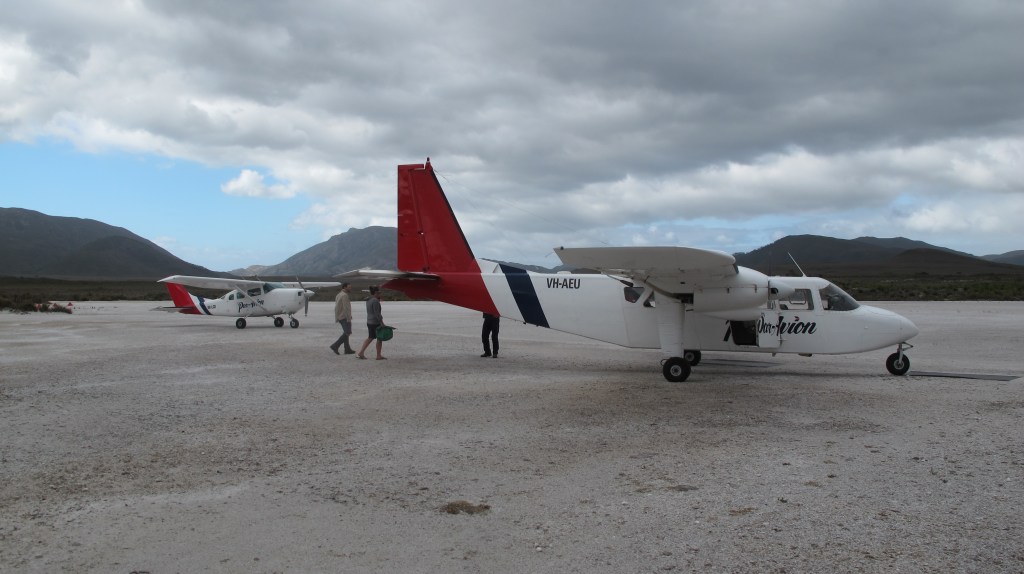
The shed at the airfield isn’t big but it has everything a walker needs – water, the log book, notices about lost persons and issues on the track and, in peak season, some greeters – a very friendly pair that remind us of the total fire ban and make sure we have all we need. After a short time taking photos, getting our gas supply from the pilot (pre-paid back in Hobart at the airfield) and watching the second plane land, there is no more putting it off. We cross the airfield, find the start of the track and walk.
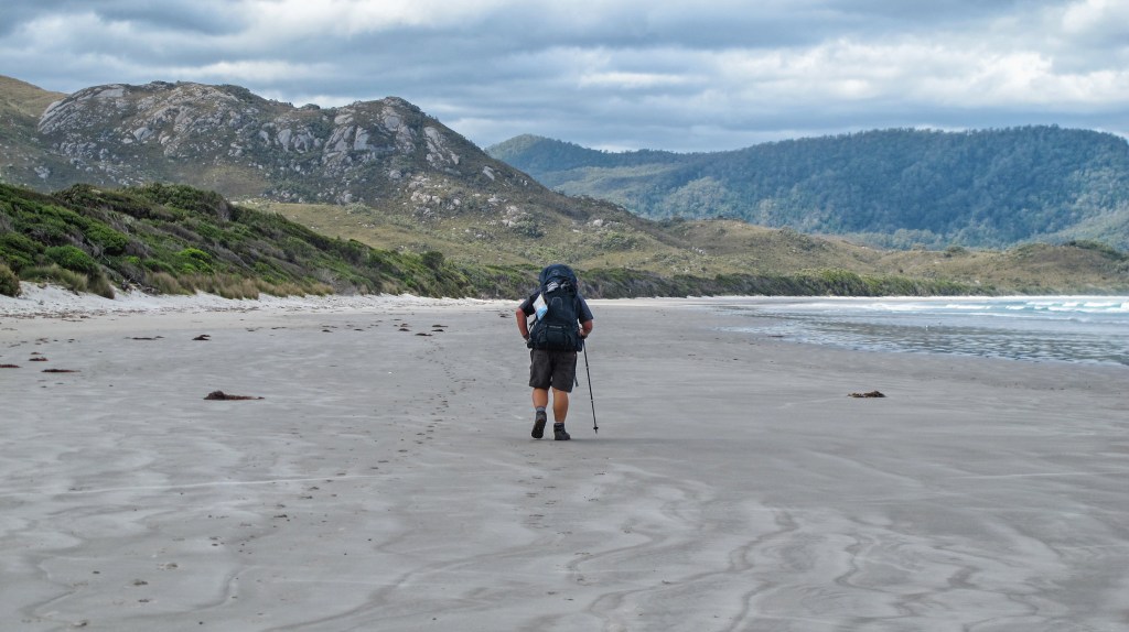
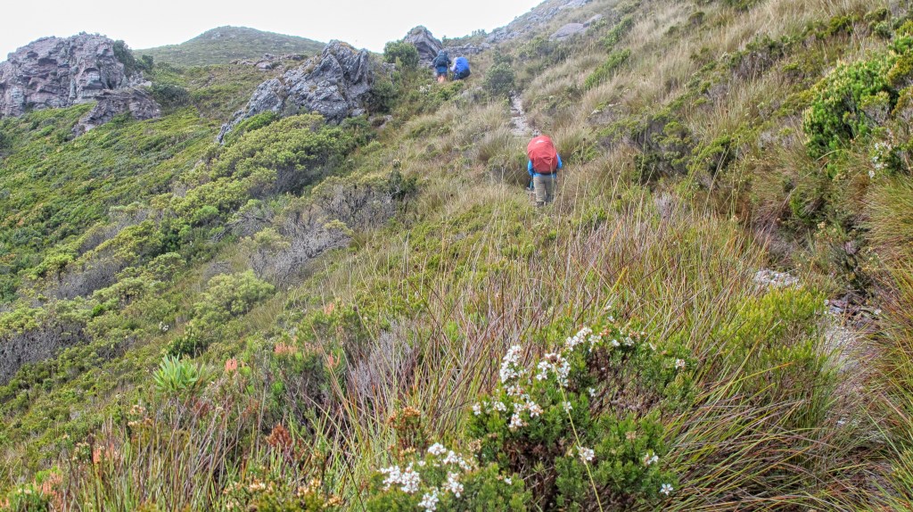
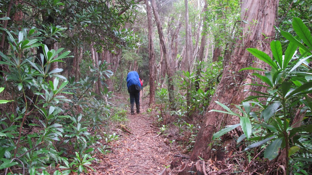
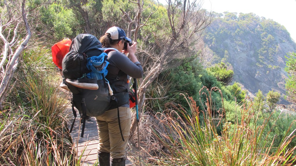
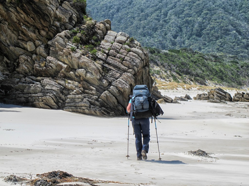
It’s warm and very windy. The boarding makes walking easy but without needing to concentrate on my feet, my mind wanders to my pack. At 18kg it’s the heaviest I’ve ever carried. I’m almost constantly adjusting the straps – tighter on the shoulders, looser, cinch the waist strap in, let it out. The chest strap impinges my breathing, now it’s not tight enough. We are not talking much. Erin and Nicole pull out ahead, almost racing to the coast. With views of Freney Lagoon in sight, they stop and we catch them for lunch. There is no shelter. We eat our Subway rolls eagerly, conscious that they may be the last interesting food for a while.
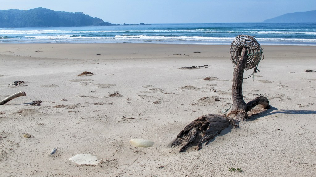
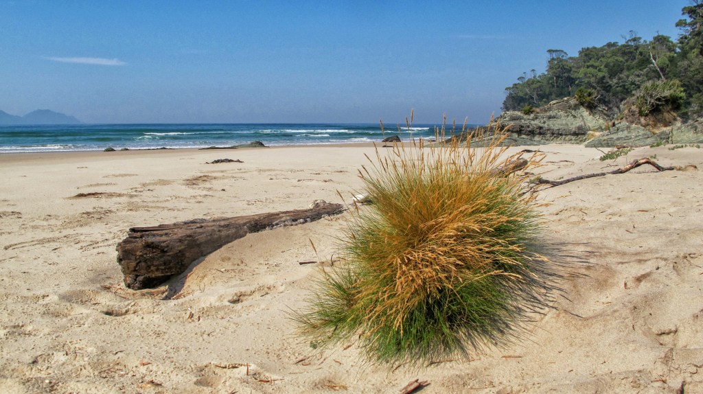
The track climbs a little, skirting the side of New Harbour Range. The views stretch out over Cox’s Bight, Point Eric, the Southern Ocean and beyond. After a short section through very long grass and coastal scrub you spill out, almost unexpectedly, onto the beach. The other group of four, from the second plane, are already here. Boots off and mucking about in the ocean. They pass us quickly, padding barefoot along the long stretch of beach – we don’t see them again after today. Soon we pass through the light forest of Point Eric, sign another log book and choose a campsite.
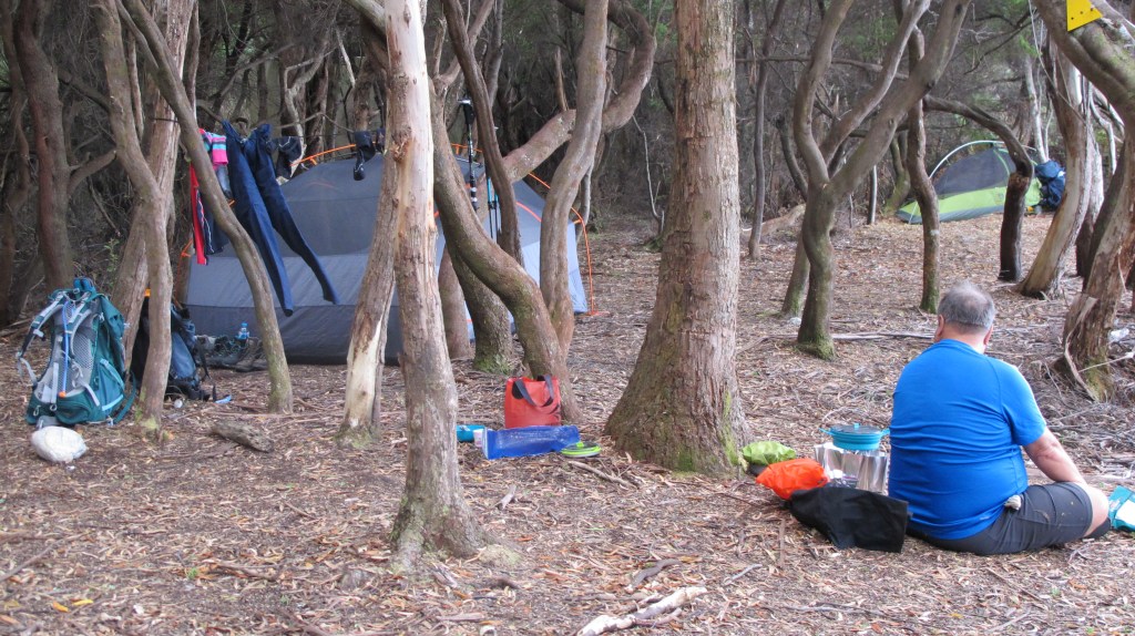
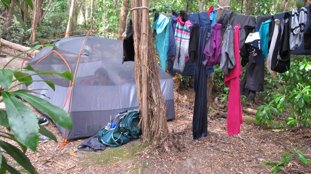
This campsite is dry and just back from the beach, there are logs are rocks to sit on and fresh water at the creek about 200m up the beach. It’s not a hard place to spend an afternoon although the flies are not welcome and we retreat into our fly-screened tents for a rest. By about 7pm all insects are gone. Nicole breaks out her wine. We had tried to dissuade her but are equally happy to help her drink it all before the Ironbounds.
Time taken – 5 hours at a leisurely pace with lots of stops. Wildlife = seabirds.
Day 2 – Point Eric to Louisa Creek – 10.5km
There seems no need to hurry, the weather is fine and there is a light breeze. We only have 10kms to travel today. Our dish cloth has gone missing. Gordon placed it to dry in his tent vestibule and gave a critter a tasty treat. We waste more time looking around for a while as this seemingly insignificant piece of equipment will be missed when trying to clean the pot after oats. Three walkers appear from the opposite direction, a man celebrating his 70th by walking the track with his sons. We spend time chatting with them before setting off along the beach towards Black Cliffs. The tide chart had indicated a low at around 11am but as we approach, it is unclear if we will be able to get around. Jagged rocks and rough waves create a risk we decide not challenge. There is a clear track cut over the back of the headland, in fact it gives some terrific views, so this obstacle mentioned in the guide book is no longer an issue. Another beach walk finds us at Buoy Creek. It burbles out to the ocean only ankle deep. The unusually dry weather in Tasmania means all our creek and river crossings are very low. A short, morning tea break here finds us meeting a solo walker. He started his morning at Louisa Bay and will make the airfield by afternoon. We are reminded of how slow we are compared to some other walkers!
From here the track turns inland. Again, it is duck boarded in large sections. This makes the track both easy and hard. One glance at the terrain and you are glad to be walking above it (the newer sections are very high off the ground allowing regeneration and minimising wet feet from flooding) the swamp, mud and buttongrass would impede progress considerably. But the flat walking means the pack sits constantly in the same position, throwing off your centre of balance and hurting hip bones and shoulder blades. We have not yet eaten enough to reduce the 4.5kg share of food in these still foreign additions to our backs and the heat is increasing. By the time we reach the base of the Red Point Hills, we are all sweating and feeling a little light-headed. The sun is beating down relieved only by gusts of wind that cool us slightly. We decide not to eat lunch until we are over the 200m hills.

Ascent is exposed and relatively steep. Many steps are cut into the slope, providing flat platforms for short rests. The wind grows stronger. Gordon struggles in this section. He moves very slowly upward, eventually joining us to admire the sweeping views back towards Point Eric. It is time for a break but no shelter from wind or sun compels us to push on. Finally, with no likely spot in sight, we just sit on the track and eat. Our water is low, we had all expected a creek and no one has carried enough. The next section of the walk should be easy and beautiful; it undulates over small rises, providing views of ranges in all directions. But it is very hot now, the afternoon heat reaching its maximum. Clusters of trees hint at a water source but the track always seems to turn from them at the last moment. Nicole and Erin have gone on ahead. Gordon is far behind. I trudge on, feet burning, sweating, reciting the 99 bottles of beer song and wishing for a drink or even just a little piece of shade.
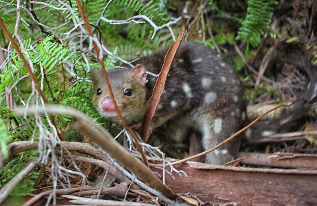
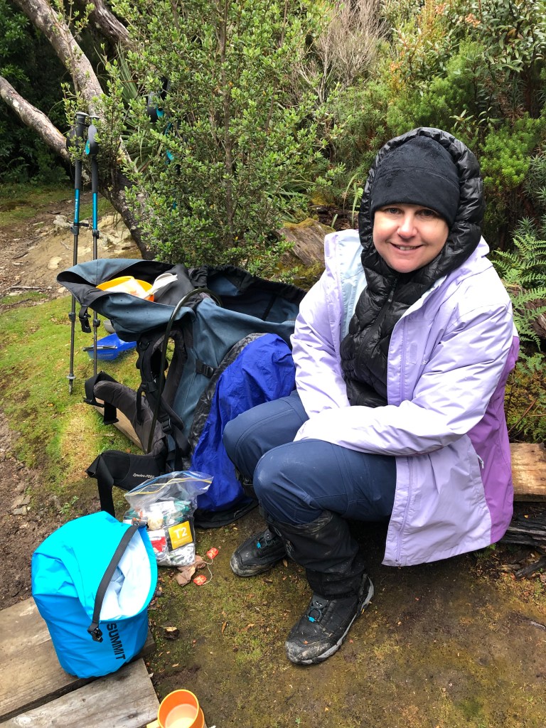
Faraway Creek is an oasis. Surrounded by tall gums, its tea-coloured water is cool and refreshing. We soak ourselves, drinking and slopping water down our backs. We don’t need the rope provided to cross but I am happy to linger and let my boots get soaked through. Our campsite is at Louisa Creek, just another 900 metres out into the heat again but more bearable now. We move more quickly. Louisa Creek has no facilities but tent sites are right on the creek. The kettle is on as we set up, cup-a-soups are made and we again retreat from the flies until evening. Nicole had been worried about animals, particularly quolls. She had read that they were aggressive and would tear through a tent or backpack in search of food. It was already a running joke, “watch out for the quolls!” So, when a shriek is heard from our designated toilet spot and a blur of fur and spots runs past our tent, Erin and I are in fits of laughter. A quoll has indeed found us and is having a lovely sniff at Gordon’s garbage bag. Nicole is scared and laughing all at once. Erin grabs her camera and successfully captures the very pretty creature. It visits Gordon later in the night and he feeds it some scroggin despite our protests that he shouldn’t encourage the wildlife. I don’t think Nicole sleeps much and she keeps herself away from all tent sides just in case. And, as much as we don’t believe this timid critter’s reputation, we do make sure we put the food bags in the centre of the tent.
In the gloaming, a lone hiker appears – Milo – we had met him at the airfield. He had walked the track already and had intended to go on to Port Davey but as that track was closed and he couldn’t afford to fly out, he had turned and come back. He is aiming for Louisa River, 7kms further on, by nightfall, so only stops to chat for a short time. He is the last person we see until Day 9.
Time taken – 6.2 hours including some long stops for lunch, cooling down and at the top of the range. Wildlife = 1 parrot, 1 quoll and 1 baby snake
Day 3 – Louisa Creek to Louisa River – 7km
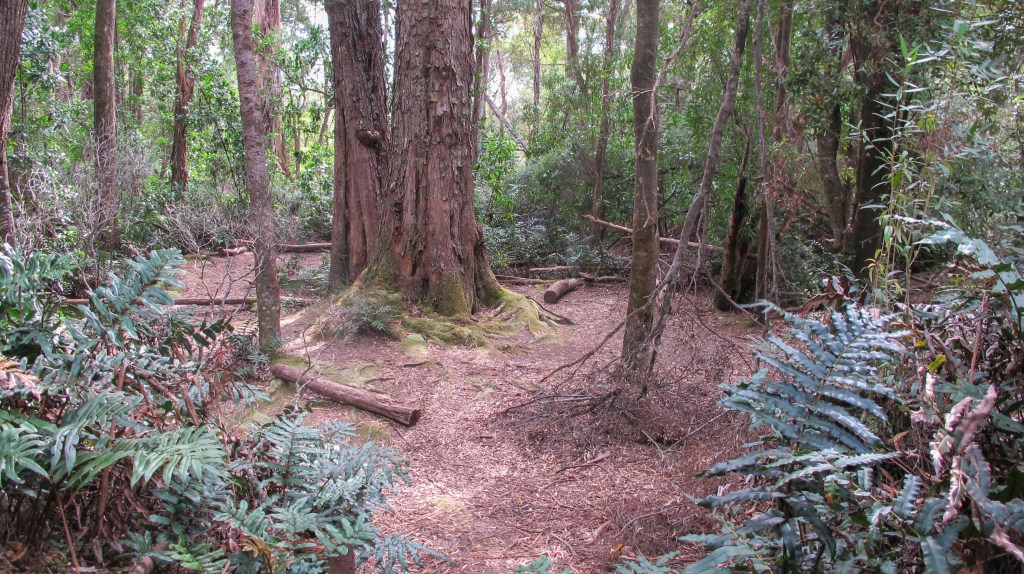
Only a short hike today through some forest and along the side of some spurs. We pack up slowly, cross the creek barefoot and then put on our boots. Once again there is a lot of duckboarding, some old style and some new. It covers a lot of muddy, marshy ground, so I am glad of it. It’s warm again but we have plenty of water and stop regularly. The Ironbound ranges loom constantly in the distance and, as we get closer to Louisa River, we can make out the trail winding up the exposed ridge. Tomorrow will be a big day.
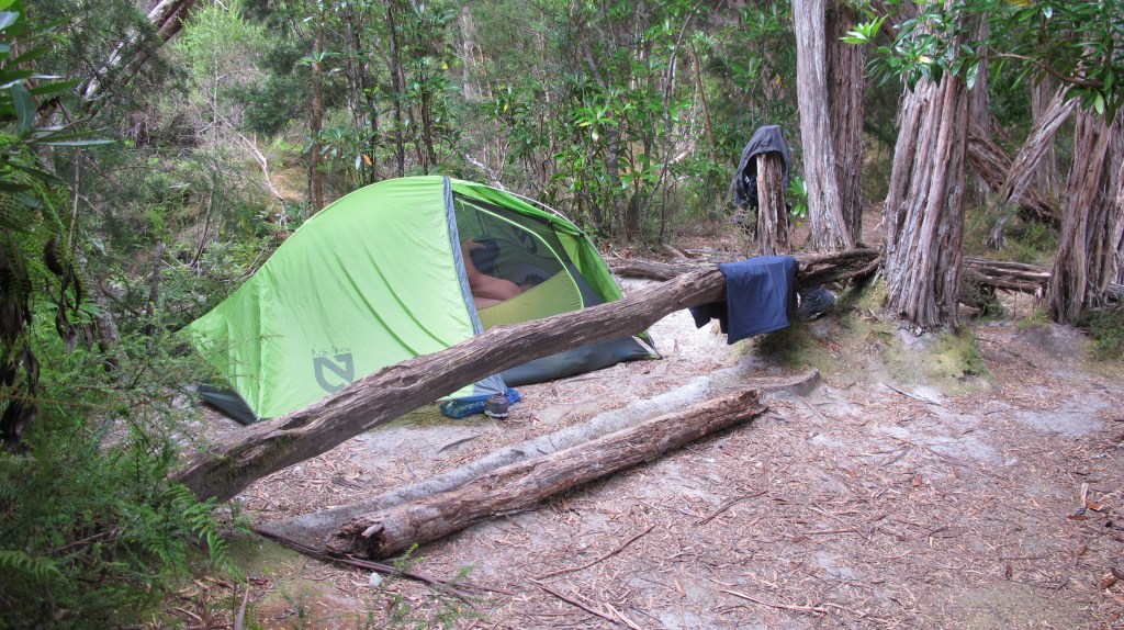
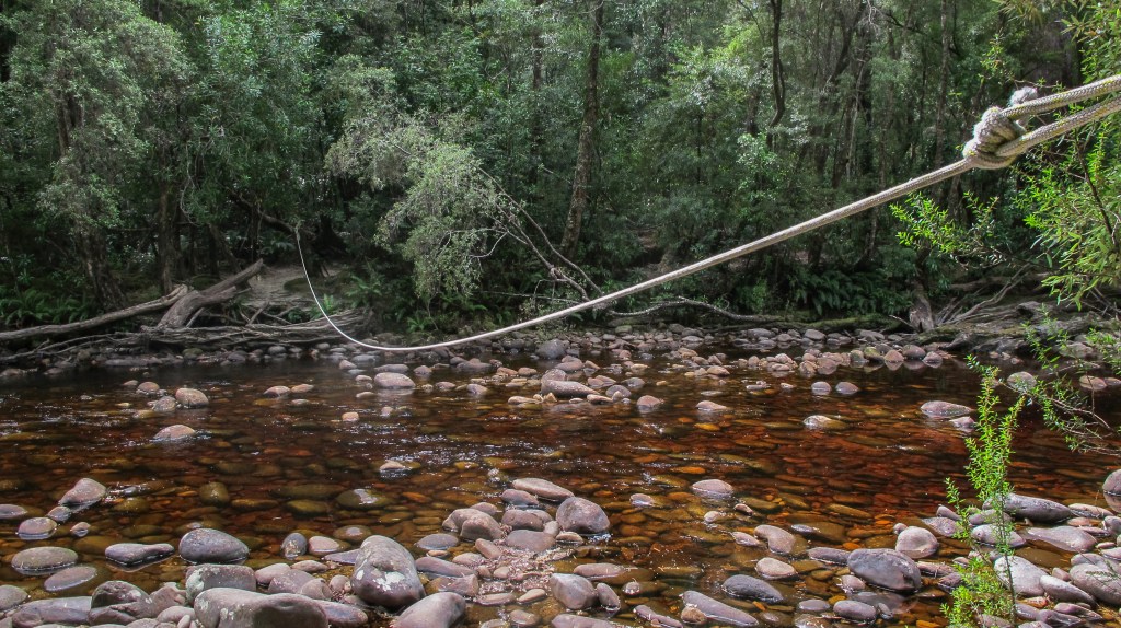
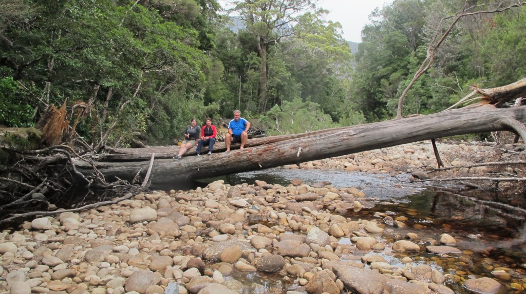
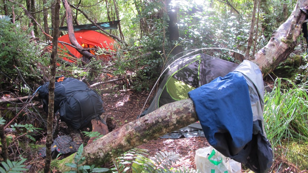
Soon we are in the trees surrounding the river. There is a rope to aid with the crossing but the water is not too deep. The campsite is large, many excellent spots complete with makeshift log furniture are there for our choosing. Lunch is our first priority, then tents and a rest. Later we take our cup-a-soups and sit out over the river on a fallen tree. It is sunny and warm and there is time for washing off in the creek and hanging things out to air and dry.
During the night Erin complains she is being dripped on and we wake to find it’s raining heavily. Water has pooled on the top of the fly and is dripping down on her bag. A towel takes care of that. I feel water beside me, near the tent seams, unzipping the tent, I step into a puddle of water. I had noticed a depression where we had put the tent but hadn’t expected it to be a lake! Some adjustment of the fly, pegging out of the sides and rearranging things inside is all we can do until morning. It’s a lesson to always be prepared for rain.
Time taken – 5 hours at a very leisurely pace with lots of photo stops.
Wildlife = 2 leeches (one in Nicole’s mouth!)
Day 4 – Louisa River to Ironbounds Low Camp – 9km
The day starts drizzly and cool. We are up at first light, hoping to get a good start on the 12km we plan to cover. Packing wet tents is never fun but it’s all done quickly and we put on rain gear and covers over our packs. Mossy forest soon gives way to the uphill track. It’s exposed and windy but allows great views. We climb quickly. There are steep sections and flatter parts that allow us to take a break. There are also enough places to get out of the lee of the wind and drizzle. I take a lot of photos that also give me a rest from the uphill.
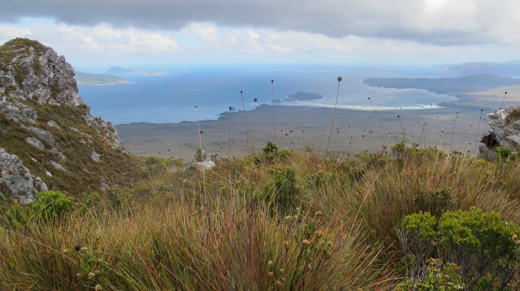
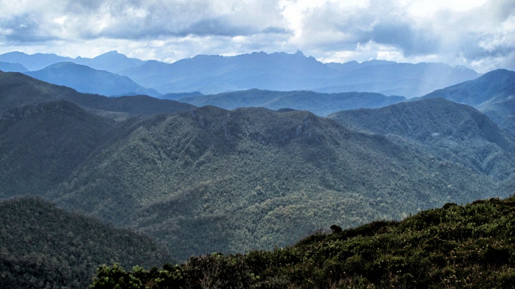
We reach a long, flat section on old duckboards that are partly submerged and muddy. From here the views west to Federation Peak are superb. The sun even comes out for a while but it’s still cold and windy with nowhere good to stop. Just when we think we are at the top, another steep part appears but finally, about 1pm, we are up top. The ascent we had dreaded was, apart from the weather, really not that bad. We had taken it slowly, stopping frequently and so, at this point, had plenty of energy in reserve.
The early part of the descent is easy, long sections of duckboards that have almost been completely overgrown but easy walking. We sometimes have to push and shove our way through the bushes and avoid tripping ourselves on the long grass. It is however, very very cold. A bathroom call takes ages as I struggle to get my pack on and off with shaking fingers and tired legs.
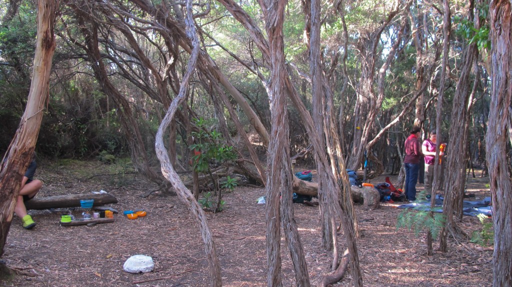
High camp is nestled in a small cluster of trees on a gushing creek. The ground is mossy and damp but there are planks for us to sit on and Gordon breaks out the kettle for tea. We plan to stop here for a long break, being aware of the tough section ahead, but it starts to snow. Proper, individual snowflake snow. It’s cold, even with puffer jackets, beanies and gloves. We have to move. Erin falls almost immediately; it’s not a good omen.
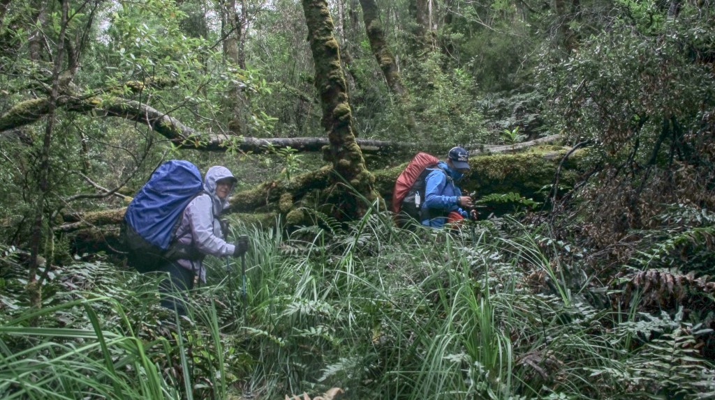
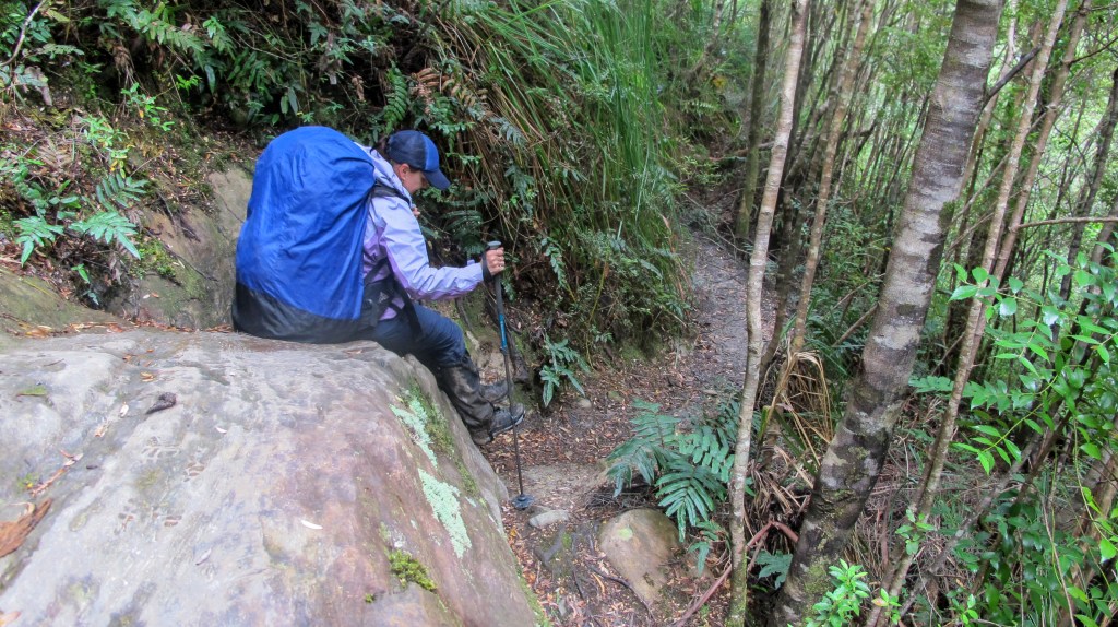
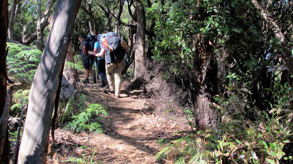
At first, it’s more duckboards but soon we are quickly enveloped by the rainforest. I cannot imagine coming up this way. Each step requires lowering myself almost half a metre, often into mud or onto a mossy branch with footing needing to be carefully considered so an ankle isn’t twisted. If I was coming up, it’d be hands and knees, all the time. It’s not the first time on the walk I’m glad we are travelling in this direction. I knew it would be hard, I’d read about it in many blogs and on forums, but the reality is still a challenge – crawling on hands and knees under wet branches, wading through mud, straddling trees to get over them getting covered in mud, avoiding slippery, muddy roots and balancing on slimy logs down a path that is largely a small, badly eroded creek and did I mention, navigating through mud. I fall three times collecting bruises and making sure my gaiters never look the same. My knees aren’t great, so the pole is deployed, constantly.
Erin and Nicole are mostly up ahead. I’m so impressed with their attitude; this is a hard day, but no one complains. Gordon stays with me. I know he can go faster and that he is used to this kind of walking, most of what he’s done in the south-west is like this and harder. I suck it up and just keep stepping down. One move at a time and eventually we reach a clearing where Nicole and Erin are waiting for us. They are literally sitting in a hail storm. The tiny pellets are sheeting down, covering the mud like a beanbag has burst open. From here it’s only 900m to low camp; a very long 900m. We know we are not getting to Little Deadman’s tonight. It’s already 7:30pm and we’d left camp at Louisa River at 7:30am. Twelve hours is enough. We are done for today anyway.
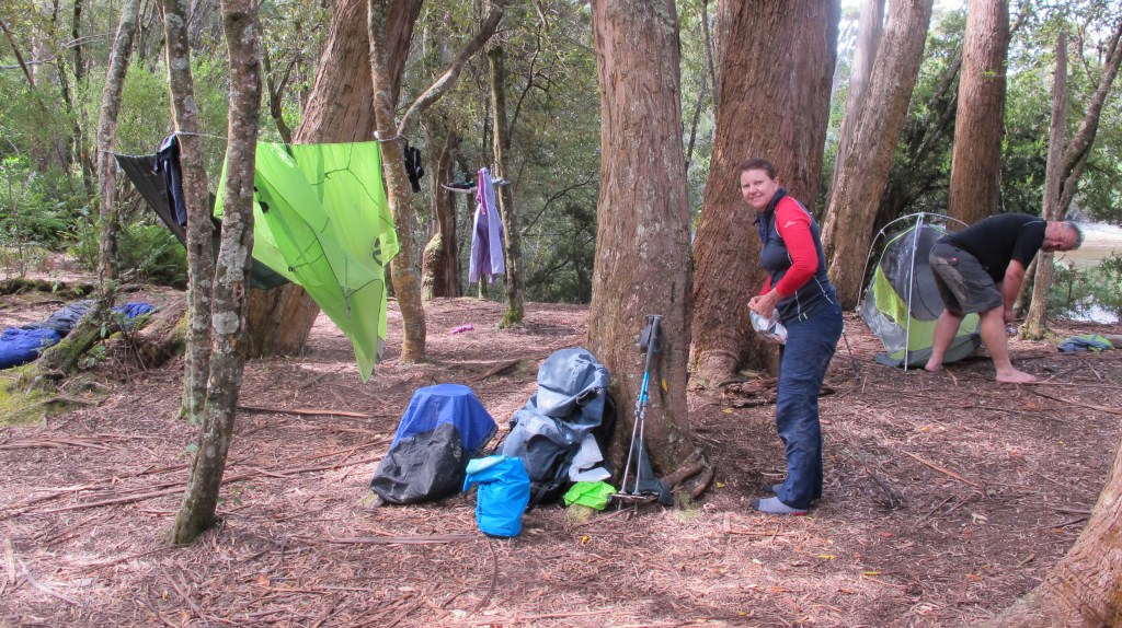
Ironbounds low camp is just a couple of clearings in the rainforest. There is room for a few, small and medium sized tents. Fresh water is from the creek a further couple of hundred metres down. Getting to it is more of the same, roots, mud and tricky footings. Gordon takes on this responsibility, bringing back our ten litre bucket full so we don’t need another trip. It is enough for our soup, freeze-dried dinners and oats and tea in the morning. There are a couple of heavy showers during the night but overall, it’s a good spot to stop if you run out of daylight as we did.
Time take – 12 hours (5 hours on the ascent and plateau crossing, 7 hours for the descent – lots of stops to cope with falls, snow and hail).
Wildlife = 1 native rat?
Day 5 – Ironbounds Low Camp – Little Deadman’s Bay – 3.5km (plus a detour)
It’s no surprise that we sleep late today. We are exhausted. So many aches and no chance to dry out our walking clothes means we put on wet, sweaty socks and muddy gaiters. The mood is high however, we are proud of ourselves for getting over and down the Ironbounds in one piece. Today was scheduled as a rest day but we are still 3 and a half kilometres from camp.
Packs are hoisted, straps tightened and we are off again, downhill 300 metres to the creek. It’s more of the same, muddy logs, slippery rocks and fallen trees – it takes 20 minutes! Erin is taking photos as we cross the small, flowing creek. We are chatting and happy and don’t notice the track being signposted downstream and to the right. Others have clearly made this mistake as the track to the left is well-trodden and seems obvious. It’s easy enough at first, well not exactly easy, but similar to the terrain we have been crossing. Then, it gets harder, more fallen trees to climb over, more overgrown and uphill constantly (we should be descending). After 20 minutes Gordon, who is at the back, calls a halt. This doesn’t feel right he says, let’s check the book. Sure enough, the one place you can take a wrong turn and we’ve taken it! So back down we go, easily wasting 50 minutes. This really deflates our mood. Back at the creek we see that the correct path is quite obvious. We just hadn’t been paying attention. It’s a good thing we hadn’t tried this in the dark and that we don’t have far to go today. We need some rest.
For another 600 metres or so the descent continues over heavily eroded and overgrown rainforest, moss and mud, lots of mud. Where we can we just walk through it, it’s easier than trying to pick around it and risk slipping anyway. Finally, after skirting the hillside, the track opens out into light, coastal forest. Beautiful old gum trees reach high and soft leaves are underfoot. The ground is drier too and, as our first coastal views come into sight, the walking becomes decidedly pleasant. The last two kilometres into camp are gorgeous. Our legs are grateful for the chance to stretch out in stride. No more knee-grinding step downs. We pass bay after pretty bay until, just on lunchtime we arrive at Little Deadman’s.
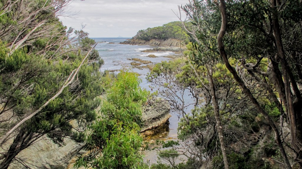
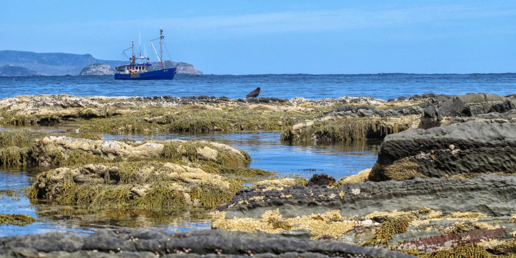
What a terrific camp! Camp furniture made out of duckboarding, rocks and logs. Loads of big, open sites with views out over the bay and lots of shelter beneath soaring gums. The afternoon and evening spent here will be among our favourites. Splashing in the creek, washing ourselves, clothing and equipment. Napping in the tent. Short walks for photos. A crayfish boat appears, dropping its pots along the shoreline. It adds to the vista.
Time taken – 3 hours including the 50 minutes for going the wrong way!
Wildlife = 1 leech in the tent, 2 quolls spotlighted at night
Day 6 – Little Deadman’s Bay to Osmiridian Beach – 14km
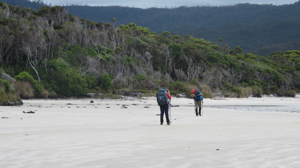
We take our time packing up camp, then head down to cross the creek, pick our way over the small, round stones and head into the bush. After a short, easy walk and we emerge onto Deadman’s Bay. This beautiful sweep of a beach comes complete with driftwood sculpture. Soon, we again exit the beach into the lightly wooded forest behind Menzies Bluff. It’s a constant ascent but easy and we travel quickly, stopping frequently at many of the coastal viewpoints, taking photos and enjoying the walking. The day is warm, however and I start to suffer as we descend to Grotto Creek. My feet are burning up in the hot, woollen socks and gaiters are adding to the misery. Gordon waits patiently, as I strip off unnecessary layers, dodging a friendly leech that has hitched a ride on my boots. It sits on the rocks sniffing in our direction. I almost feel sorry for it.
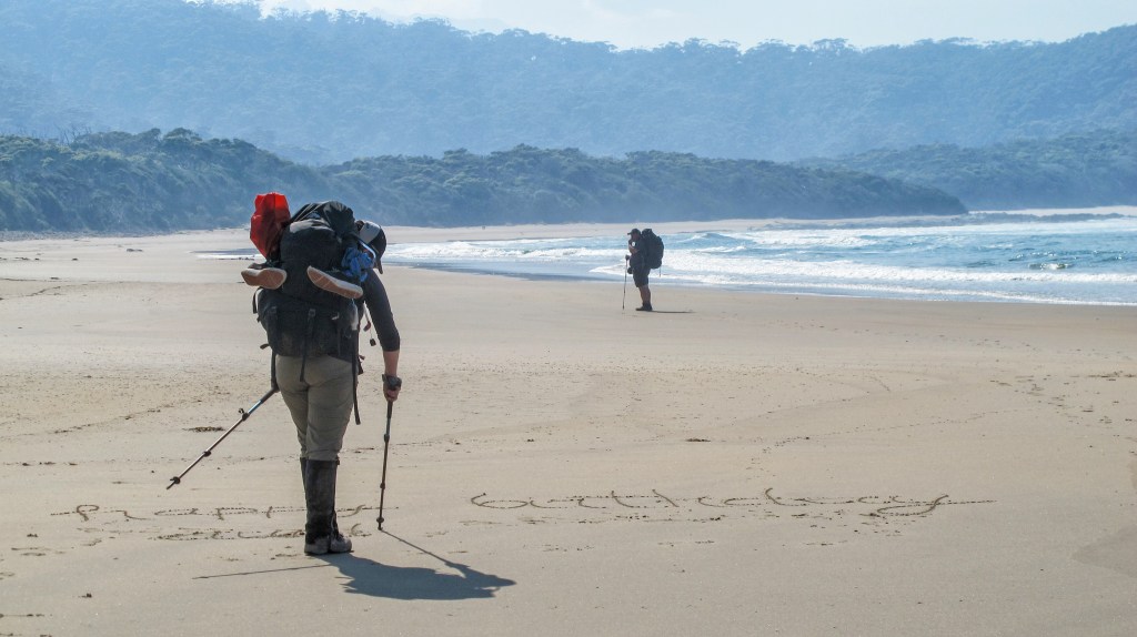
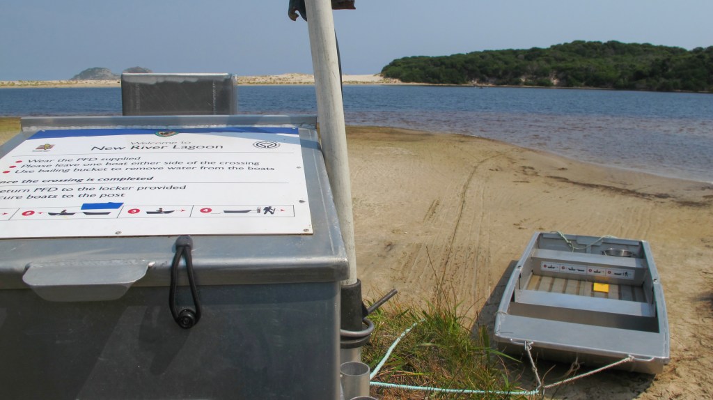
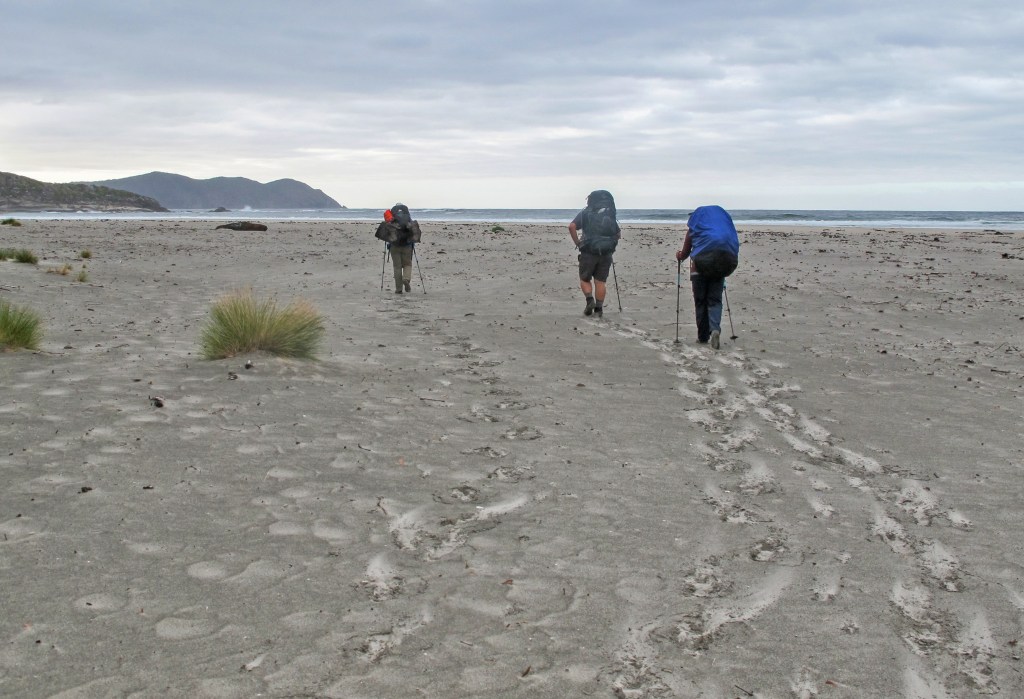
To cool down, I decide to walk the 4km of Prion Beach in camp shoes. Bliss. Nicole and Erin have taken off ahead, leaving messages in the sand to encourage us along. The march flies decide Gordon is their master and surround him in an attentive halo for the entire length of the beach. The walking is easy, but again it gives nothing else to focus on except the heaviness of the pack and the heat of the day. The 99 bottle of beer song once again becomes my mantra. We make it to the end of the high dunes and cross to the lagoon and the waiting punt. The beach does continue, all the way along to just below the headland of East Prion campsite. But the water crossing there is reported as risky due to deep water, currents and quicksand…yep, quicksand. We decide to stick with the official track and cross the lagoon by boat.
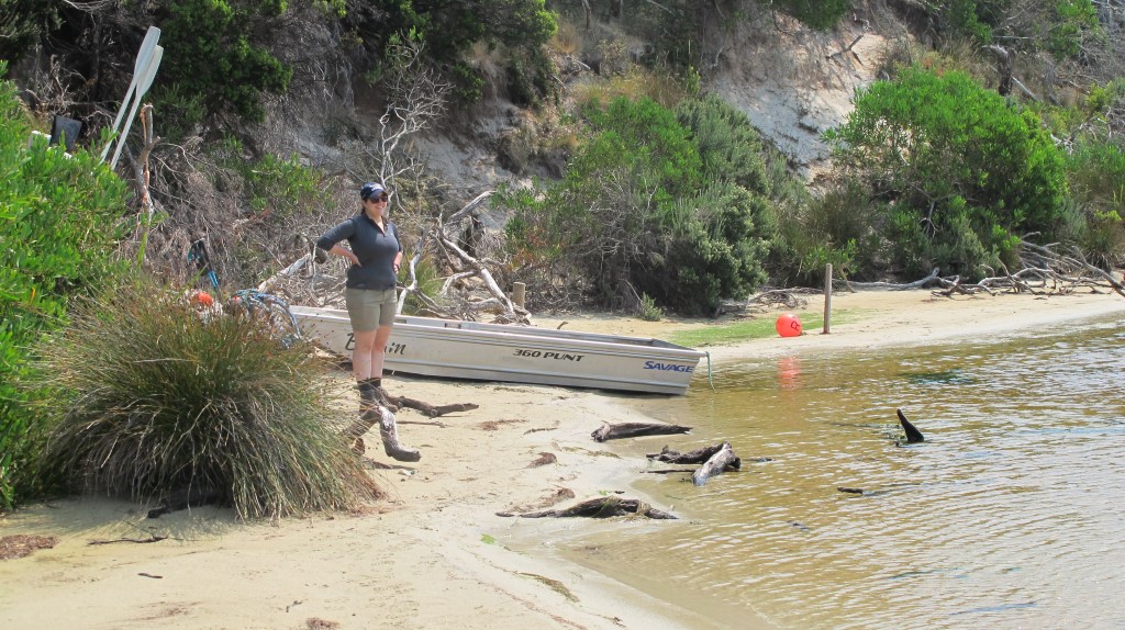
There are three boats altogether and it just depends on your luck whether there are two on your side of New River Lagoon. If not, as it turns out for us, you have to row across, unload, drag one of the other boats down, tow it across to the other side, drag it up and secure it to the post and then row yourself back. The good news is that the new punts are quite large and the four of us fit easily into one, along with our backpacks. So only one poor sap gets to do the boat shuttle. We use the shelter of New Prion campsite to prepare lunch while Gordon completes his task. We consider camping here – we’ve already walked 9km today and it is 3pm, but we reason that it’s only 4km to Osmiridian Beach and we’ve heard that it’s a much nicer campsite and there are loads of march flies and mosquitoes here plus, it would be good to make a little more progress.
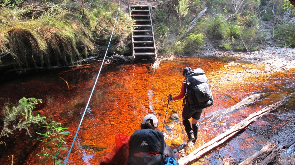
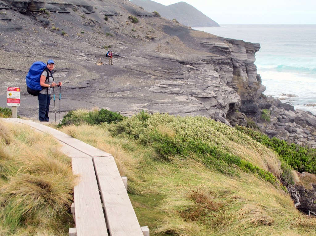
With lunch done, we pack up slowly but soon pick up pace as we head into the coastal scrub behind the dunes. The track undulates, it’s hot and airless. We don’t mind uphill but the pointless up and down starts to grate. Thankfully, the track turns further inland towards Milford Creek. Usually this creek has required a deep crossing, but a shiny, new bridge awaits us. Lovely, stainless steps are cut into the hillside making the walking much easier. We stop on the bridge, take pics and chatter. The guide book says the track will drop back down to the creek bank but instead it heads even further inland. This is clearly a new section, many of the steps are steel and there is new duckboarding. It’s already overgrown by scrub and overblown by sand. The up and down resumes. Steep ups making progress slow. We are all hot and our water supplies are again low (the water at New Prion was not appealing and we didn’t think we would need a top up!). The mood drops as we hadn’t expected a difficult section. It’s nearly 6pm when we reach East Prion campsite (maybe we should have braved the quicksand). Again, we consider stopping but even though there is a view, its windy, the campsite is small and fresh water is a sharp climb down to a creek, so we push on.
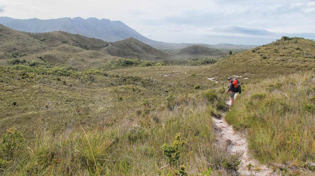
The track levels out as it leaves the coast, through a short section of forest and then out into a buttongrass plain just as the sun begins to set. The views to Precipitous Bluff and back to the ocean are stunning. Our spirits lift even as sections of mud start to appear with more regularity amongst the buttongrass. We spy the new toilet at Osmiridian and turn off in that direction. This section really requires some duckboarding as the track has splintered into twenty directions, a function of people trying to avoid swamp and mud. Finally, at camp, soup and dinner are done in one sitting. There is no lingering tonight though, as soon as dishes are done, we all crawl gratefully into bed.
Time taken – 9.5 hours including rowing the lagoon, a long stop for lunch and lots of stops in the afternoon heat.
Wildlife = 1 leech on a boot
Day 7 – Osmiridian Beach to Granite Bay – 7.6km
A slow-moving morning. My legs are leaden. I can only guess it’s from the heat of yesterday but I tell my body, yup, we are putting that pack on again. Surely the weight has reduced a bit now? It is feeling lighter; there is certainly more space inside. The back-track to the main track is fast even though it is through the muddy, swampy, twenty potential routes section. We initially climb gently through the buttongrass still enjoying the views to our left and right. The track then climbs into open forest. It’s warm again but the walking is relatively easy, a few muddy sections but nothing hard. I start to struggle as the climb steepens. There is no reason, just one of those “heavy leg” days. I walk slowly, one foot in front of the other, deep in my own head. I fall quite a way behind and Gordon stops to wait. I appreciate this but feel bad all at the same time. Our breaks become more frequent at Gordon’s insistence. This is good but is also blowing out our walking time.
It’s a relief to head downhill to Surprise Bay, a beautiful beach with rocky outcrop formations. We stop for a scroggin break, refill water bottles and enjoy walking beside the crashing waves. The climb off the beach is steep – there is a rope with knots at strategic points, to help you up the rockface. We clamber up to the campsite and find an almost sheltered spot out of the wind to have lunch. We are on the second salami day after roast beef and pastrami on the first few days, the salami isn’t as nice but with cracker barrel cheese and the last of the sun-dried tomatoes with our wraps, the food is pretty tasty. We have a long break here and there is a short debate about stopping. I can tell Gordon is concerned how tired I am, but a camp here means pushing the whole trip out another day. We have some emergency food, however it would mean missing our scheduled pickup. It’s only 3.1km to Granite Beach; I think I can do it without injuring myself from a stumble or something silly that can happen when you get tired.
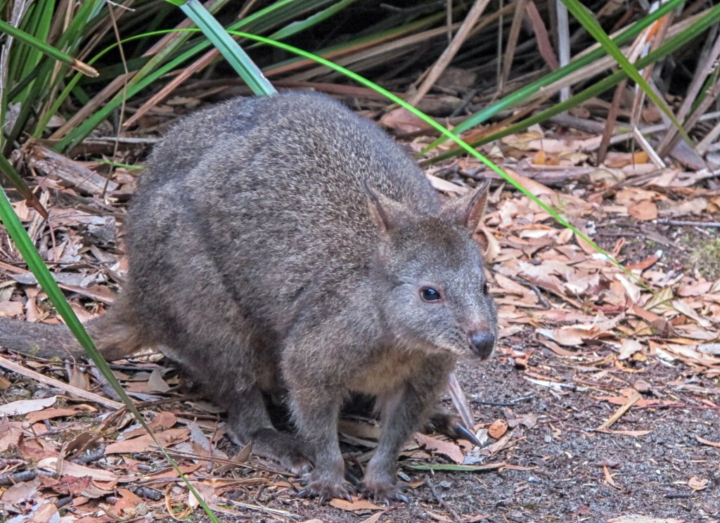
I decide to tackle the next hill ahead of the others. It’s a climb up and over a headland. Easy walking underfoot but quite steep in sections. The only thing that worries me about being out in front is running into a snake basking in the warm afternoon sunlight. I’m constantly tapping my walking stick and making a noise. Being in front of the others is good. I take 20 steps and then catch my breath. Continuing uphill in this fashion I make good progress and my legs are finally feeling better. Nicole and Erin soon catch me up but they decide to stay behind me, liking the slower, but continuous pace. We chatter happily and before we know it are at the top. The walk from here is through lovely fern covered open forest, there is still the odd tree to clamber under or over but not much mud and we can see views out to the ocean. There is a nice breeze blowing and dappled sunlight creates a gorgeous afternoon atmosphere. Granite Beach is sandy at first but soon the rounded rocks, that are stacked high above the tidal point, are meeting the ocean. Nicole and I try to outrun a few waves to avoid the rocks but eventually, we have to start our hop to the end of the beach. It’s fun but tiring and just a bit slippery. I slow down, not wanting a sprained ankle at this point in the walk! Access to the campsite is via a hand over hand climb up the sharp rock wall, next to a waterfall. Fresh water is from the creek above. Erin has already arrived and comes excitedly out from the trees, gesturing that she has been photographing pademelons. Two of them in fact. It is a lovely campsite, but I’m done. Once the tent is up, I’m inside. All energy gone. Wall meet Lisa. A light rain means Gordon climbs inside with us to eat our meal. He hasn’t been in our tent palace yet and is impressed with how roomy it is. A quick clean up after dinner and then early bed for all.
Time taken – 8 hours at a slow pace and including an hour for lunch and lots of photo stops.
Wildlife = 2 pademelons
Day 8 – Granite Beach to South Cape Rivulet – 12km
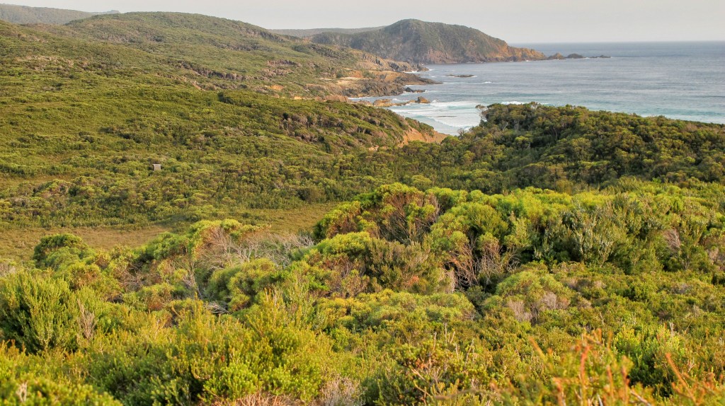
Today is another big climb day. Up to 700m over the South Cape Range. Leaving camp early, we climb almost immediately, surrounded by forest. It’s steep, but we use the slow and steady up method with short stops to catch our breath. In good time, we reach Flat Rock Plain, just below the summit. The views are spectacular here, back over the past few days of walking.
While the others go out ahead, I retreat down the path a bit for a toilet stop. Rather than doing it directly on the path, I step off onto a sandy mound. Bad move. I feel one bite, look down and I swear these big, black ants are lined up in formation, they have mobilised and then they attack. My pants are around my legs. I start laughing at the absurdity of the situation at the same time as screeching in pain as a literal army of Jack Jumper ants march up my leg and into my boot. They are biting me as they go and I swat them away as fast as I can. Gordon, Nicole and Erin look on in astonishment trying to figure out what’s happened and cracking up at my bare butt bouncing around. One ant, let’s call him Jack Reacher, secures a high position on my thigh and trapped between my trousers and the outside world, he is determined to sting his way to freedom. He loses, but that welt lasts for days. I later find out how dangerous these ants are and can’t believe I have so carelessly stumbled onto their nest. Luckily, I have no adverse reaction or my situation could have been quite dire.
Resuming the walk, we come across some of the deepest, widest, most unavoidable mud of the hike. It’s less of an effort to just walk through it, though in many places, logs, rocks or pieces have timber have been placed strategically so you don’t sink too far. I still manage to get stuck however, so deep in mud that the suction stops me from freeing myself and Nic has to grab my arm. I’m actually pleased that I’ve been properly initiated into the south-west mud club! Despite my two mishaps, we are moving quickly and hopeful today won’t be as epic as the Ironbound’s day.
After just a little more steep walking, we pass the highest point although there is no view. Then we descend. It’s easy at first, but soon changes to the same eroded, muddy, tree dodging in the rainforest situation we have encountered before. We stop at the small creek below Trackcutter’s camp and top up our water. The track ascends again from here, it’s literally cut through the hillside in one place and we only just squeeze through with our packs. Lunch is at Trackcutter’s. It’s cold and windy but would be an okay place to camp (just remember to collect your water from the creek).
For some reason, I have misgivings about the next descent. Looking at the map, everything points to more mud, rainforest and tree dodging even though the guidebook says nothing about it. And, I’m right, the next few hundred metres seem to go on and on and our progress slows right down. Then, we are out, on duckboarding, walking fast. We look at the map and see we have two more small hills to cross. Suck it up. Get them done. I power into the forest, enjoying the walking. First hill, done easily then down a gully, why so far down? Next hill, the up is fine. It’s beautiful actually, open forest, late afternoon sunshine on ferns. Some mud here and there but mostly it’s easy underfoot on soft leaf litter. There’s only a k and half to go and we are all striding along quickly. Half an hour, then an hour…is this right? We are still high above the ocean, some views out here and there. The track is definitely descending but nowhere near sea level. Not for the first time, we question the timings and distances given in the Chapman book. Mostly, we attribute our slow times to our age and fitness, but this is not right. We had walked the 4km of Prion Beach in an hour but this kilometre and a half is taking well over that??
Finally, we burst out of the forest right onto the banks of South Cape Rivulet. It’s not too high, knee deep. I can see why you would have trouble crossing in high water but we wade over easily. A left turn and the campsite is next to the creek. We try to get our water from further upstream, worried about brackish water, but it seems fine. This is another lovely campsite. The sites are well spread out, flat and there are plenty of logs to sit on. We also soon have a visitor, a cute pademelon that knows campers come with food. We try to make the most of our last night. We’ve saved the roast lamb and vegetable freeze dry, a mutual agreement that the meals with separate potato are the best, until last. I fall asleep to the sound of the ocean and reflect back over the past week.
Time taken – 10.2 hours. The ascent was at a good pace but the descent was slow to avoid injury and navigate the mud and overgrown and eroded track.
Wildlife = 1 pademelon, 1 echidna

Day 9 – South Cape Rivulet to Cockle Creek – 11.5km
2pm is our meeting time with Kevin from Tassie Wilderness Adventures, so we set off early to make sure we are there in good time. The beach, in the early light, is gorgeous. There’s a gentle breeze and we walk along chatting, equally sad and happy to finish this adventure. Today is meant to be an easy day, just Coal Bluff to cross, beaches and a flat(ish) walk out. The track leaves the beach, climbs through some coastal scrub and then descends onto another beach again. It’s one of the best features of this track, the mix of scenery. Coal Bluff isn’t difficult either and the weather is perfect.
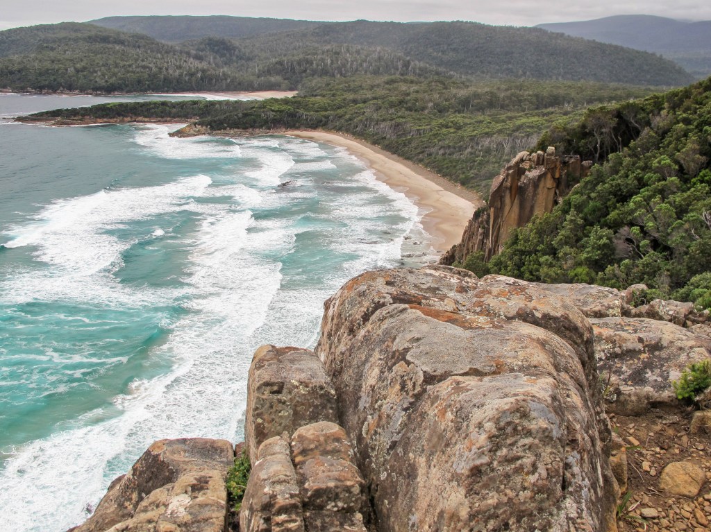
From Coal Bluff, we descend to the beach next to Lion Rock. So many potentially awesome photographs here. We see the track to the campsite leading back up behind the dunes but continue along the beach. The cliffs are increasing in height and before long we reach the stone steps that lead up to the viewpoint above the beach. Many people walk out to here from Cockle Creek, it’s easy to see why. The views are superb. We meet a guy, who is taking pics with his iPad, he tells us that the track is actually closed and that he has slipped past the ropes. We now realise why we haven’t seen anyone for the past seven days!
The track turns inland now, lots of duckboarding and it’s well-maintained. We pause in the trees for a lunch break. Our new friend passes us on the way back to join his friends on a boat. They are circumnavigating Tasmania. We joke that if the road back to Hobart is still closed by fires, we may need a lift on the boat. After lunch, we hit a long section of boarding and we pick up the speed. It’s really nice to just walk without watching every step. We try the phone every now and again. None of us has Telstra so no luck there. Gordon tries the satellite phone he has carried the whole way. He had charged the battery before we left and kept it off but the battery has drained. It’s a good thing we hadn’t needed it. We still have the Spot, so would have been fine to set off an emergency signal.
The track climbs a little into some light forest, there’s even a few tree roots to dodge. Nicole and Erin pull away from Gordon and I. My feet are hurting, mostly around the toes and it’s slowing my pace. Soon, we hear a faint cooee, then a louder one. We respond and are met with yells of hurry up! The girls are waiting to cross the finish line. Nicole is crying and smiling. We all hug. It’s an emotional moment.
There is a notice in the shelter, next to the log book, that confirms the track closure two days after we had set off. We were allowed to finish as there had been no immediate risk. We had had snow and hail and lots of rain, we had no idea that the fire situation had worsened, in fact 8 houses had been lost. As we reach the National Park office we see a ranger waiting for us. We wave hello and he tells us he has been waiting for us and that Kevin is on his way. Sure enough, at three minutes past two, the Tassie Wilderness Experience van comes into view.
Time taken – 5hours 45 mins, mostly at a good pace but lots of photo stops and a longish lunch.
No wildlife.
If you have any questions about the hike please email us at dreamcatchmetravel@gmail.com
Categories: australia, Tasmania, Wild places
")

")


")
")
")

")


")


")

")


")

")


")


